How I-15's Role in Nevada's Urban Growth Shaped Las Vegas's Transportation Network Since 1960
How I-15's Role in Nevada's Urban Growth Shaped Las Vegas's Transportation Network Since 1960 - I-15 Origins And The Rise Of Auto Tourism In Las Vegas 1960 1965
The period between 1960 and 1965 witnessed the pivotal role of I-15 in reshaping Las Vegas's transportation system and propelling it to the forefront of auto tourism. Serving as the primary link between Los Angeles and Las Vegas, I-15 catalyzed a remarkable surge in visitors, a tenfold increase from a million to ten million in a mere five years. This rapid influx of tourists coincided with a burgeoning urban landscape, particularly the development of the Las Vegas Strip, where the construction of large-scale resort complexes catered to the expanding travel market. While infrastructure expansion on I-15, like the Tropicana Avenue overpass, remained limited during this time, its role as a critical artery remained crucial, underscoring the burgeoning population and economic growth. Las Vegas's transformation into a major tourist destination and a multibillion-dollar industry was, in large part, intertwined with the infrastructure developments spurred by I-15. The interplay between transportation infrastructure and the city's growth demonstrates how transportation systems not only foster travel but also fundamentally influence urban environments and cultural identities. The highway's development fundamentally linked the city's trajectory with the allure of car-based travel, leaving a lasting imprint on the Vegas landscape.
The Federal-Aid Highway Act of 1956, which aimed to modernize the nation's transportation infrastructure, spurred the construction of I-15. This was a significant move to improve interstate commerce and provide a more efficient route across the country. During the early to mid-1960s, Las Vegas experienced a sharp increase in the number of tourists arriving by car. This surge, heavily influenced by the newly accessible I-15, led to a remarkable jump in hotel occupancy, from around 57% to 75% during peak travel periods.
Nevada's transportation authorities predicted a considerable increase in traffic volume, but even their estimates were surpassed by the reality of I-15's impact. Daily vehicle counts climbed to over 10,000 during this period, demonstrating a fundamental shift towards automobile travel as the dominant mode of transport. Before the arrival of I-15, US Route 91 was the main access route to the city. However, this road wasn't equipped to handle the growing influx of vehicles due to its narrow design and outdated infrastructure, clearly indicating the need for a major highway upgrade.
It's intriguing to note that I-15's design incorporated several features considered futuristic at the time, such as wider lanes and limited access points. The primary goals were to enhance safety and ensure smooth traffic flow, which remain core tenets of modern highway engineering practices. The blossoming of auto tourism coincided with the rise of the family road trip as a popular vacation mode. This trend was fueled by the improvements in car design and the growth of motel chains strategically positioned along interstate routes.
The presence of I-15 had a profound influence on Las Vegas's local economy. By 1965, numerous businesses catering to the influx of travelers, including restaurants, gas stations, and motels, sprung up, dramatically altering the city's landscape and economic foundations. The highway construction necessitated upgrading existing roads, which included innovative techniques like incorporating concrete barriers and constructing wider overpasses, later becoming industry standards in subsequent interstate projects.
The rapid growth of auto tourism and its related infrastructure sparked early conversations around urban planning and traffic management. Concerns over traffic congestion, which were initially debated during this time, have now taken center stage in contemporary urban engineering discussions. I-15's influence extended beyond transportation, providing the catalyst for events such as the Las Vegas International Car Show. This illustrates how infrastructure development can foster not only economic growth but also cultural and recreational endeavors revolving around automotive interests.
How I-15's Role in Nevada's Urban Growth Shaped Las Vegas's Transportation Network Since 1960 - How Paradise Valley Neighborhoods Grew Along I-15 During 1970s Expansion

The 1970s witnessed a surge in development along I-15, particularly within the Paradise Valley area, reflecting the broader pattern of urban expansion fueled by Nevada's growing transportation network. The highway's presence acted as a magnet, attracting both new residents and development opportunities. This period saw the construction of a wave of new residential communities designed to accommodate a growing population, often at the expense of existing neighborhoods. While I-15 undoubtedly provided increased access and boosted economic opportunities for the region, it also exacerbated the issues of urban sprawl and community disruption. The rapid development in Paradise Valley can be viewed as a microcosm of the larger societal changes happening across Las Vegas, revealing a tension between economic growth and the preservation of existing communities and cultural heritage. The growth experienced along I-15 during this time created a more complex and interconnected city, but also brought to the forefront the challenges associated with rapid development, which would continue to shape Las Vegas's urban landscape for years to come. The changes within Paradise Valley are a reminder that transportation infrastructure development, while beneficial, can have unintended consequences for established neighborhoods and their cultural makeup.
The 1970s saw the emergence of Paradise Valley neighborhoods alongside I-15, reflecting a broader shift towards car-centric living and suburban development. It wasn't simply about building houses; it was about creating a new type of urban landscape centered around roadway access. This period brought about significant zoning changes, tailored to the needs of burgeoning residential areas, businesses, and the accompanying infrastructure, hinting at the evolving nature of urban planning in response to changing needs.
A significant driver of this growth was the concept of "drive-time" real estate, where property value was increasingly tied to proximity to major highways. This concept profoundly shaped land use and development patterns in the region. Paradise Valley's street layout deviated from the earlier radial designs, adopting a grid pattern. This change reflected a growing recognition amongst planners that efficient traffic flow was paramount in suburban environments.
I-15's influence also extended to household size. The suburban landscape of Paradise Valley, with its emphasis on space, attracted families who sought larger homes than what was available in older, denser urban areas. Originally conceived as a middle-class haven, Paradise Valley gradually transitioned into an economic nexus, drawing businesses eager to capitalize on the burgeoning population concentrated along I-15.
Infrastructure advancements paralleled the expansion of I-15. Innovations like synchronized traffic signals in surrounding neighborhoods were implemented to facilitate smooth transitions onto larger arterial roads, signifying a shift in how urban areas managed traffic. Yet, I-15's development also brought about new challenges. The increased traffic and noise pollution that followed exposed a flaw in balancing development with the well-being of local communities.
Interestingly, as the population swelled, urban planners began incorporating public facilities like parks and schools. This demonstrated a burgeoning understanding that highway expansion needed to be paired with comprehensive community services. The rapid growth of auto-dependent neighborhoods like Paradise Valley prompted discussions concerning equity in urban development. Accessibility to transportation infrastructure became increasingly intertwined with neighborhood desirability and socioeconomics, suggesting a need for a more balanced approach to future planning. These dynamics highlight the ongoing tension between fostering growth and maintaining community well-being in the context of rapid change.
How I-15's Role in Nevada's Urban Growth Shaped Las Vegas's Transportation Network Since 1960 - The North Las Vegas Industrial Hub Development After I-15 Completion 1975
The 1975 completion of I-15 acted as a catalyst for substantial industrial growth in North Las Vegas. With improved access to land, the area rapidly transformed into a significant logistics and distribution center. Projects like the Vantage North Industrial Development, a large logistics park, and the early planning stages for the massive APEX Industrial Park illustrate this shift. North Las Vegas's industrial sector has since experienced significant expansion, accumulating a substantial amount of industrial and logistics space and demonstrating consistent growth in demand each year.
While this expansion has undeniably brought economic benefits, it raises concerns about the long-term effects of rapid, intense development in the area. As North Las Vegas embraces its industrial identity, challenges around balancing industrial growth with existing residential communities become increasingly apparent. The city's growth story, now strongly influenced by industrial development, mirrors broader urban planning dilemmas that involve reconciling economic progress with community considerations within a rapidly changing metropolitan landscape. The situation serves as a reminder of the complexities involved in managing urban expansion, where finding the right balance remains a crucial aspect of Las Vegas's continued evolution.
The completion of I-15 in 1975 marked a turning point for North Las Vegas, particularly in its industrial landscape. The highway's presence spurred a rapid influx of over 100 new businesses, generating a notable increase in employment and altering the city's economic profile. This growth was largely driven by the ease of access I-15 provided to both local and national markets, leading to a surge in industries focused on logistics and warehousing. It's interesting how this shift capitalized on the highway's role as a key transport link in the southwest.
One of the most noticeable impacts was the improvement in freight transportation. The average speed of freight transport from North Las Vegas to key markets notably increased, leading to a roughly 30% reduction in travel times. This efficiency played a crucial role in establishing North Las Vegas as a logistics center, highlighting the powerful link between infrastructure development and economic competitiveness. The design of new warehouses in the area evolved in response to these needs, with developers integrating innovative features like wider freight doors and taller ceilings to streamline distribution processes.
However, the increase in traffic volume on I-15 surpassed early predictions. Daily vehicle counts quickly climbed past 100,000, placing immense pressure on the local transportation network. This necessitated swift upgrades and alterations to accommodate the increased traffic flow. It's quite intriguing to observe how the urban landscape adapted to such rapid change. In this context, the city began prioritizing truck traffic flow, implementing strategies such as dedicated truck routes and enlarged intersections. This shift in planning focused on managing freight movement efficiently, a theme that remains central to many urban engineering challenges today.
The economic effects of this industrial boom were striking. Property values along the I-15 corridor saw a remarkable rise of up to 200% by the late 1970s. This reflects the intense economic growth and increased investor interest in industrial real estate spurred by I-15's impact. This industrialization also brought about significant workforce changes. As opportunities increased, workers from other parts of the country moved to North Las Vegas, fostering new community dynamics and cultural exchanges.
The transformation into an industrial hub wasn't without its challenges. Early zoning regulations struggled to keep pace with the rapid development, causing some complexities as industrial, commercial, and residential areas began to overlap. This, in turn, led to potential conflicts that needed careful management. Interestingly, the rapid growth of the North Las Vegas industrial sector initiated discussions about regional planning. The realization that transportation and resource access transcended city boundaries led to the formation of partnerships among neighboring municipalities. It's fascinating to see these early stages of collaborative governance emerge as a response to the changes brought about by a significant transportation infrastructure project. The North Las Vegas industrial hub story offers a unique perspective on how highways can reshape urban environments, economies, and even governance structures. The intersection of urban planning, engineering, and economic development is clearly evident in how North Las Vegas navigated the transformation prompted by I-15.
How I-15's Role in Nevada's Urban Growth Shaped Las Vegas's Transportation Network Since 1960 - I-15 Spaghetti Bowl Construction Changed Downtown Access 1988 1992
The period between 1988 and 1992 saw a major overhaul of the I-15 Spaghetti Bowl, a critical interchange in downtown Las Vegas. The project aimed to address the escalating traffic congestion that had become a defining characteristic of the area. The sheer volume of vehicles using the interchange—which links I-15, I-11, US Route 93, and US Route 95—had outpaced all earlier projections, highlighting the evolving challenges of managing traffic flow in a rapidly expanding city. While the reconstruction undoubtedly aimed to improve traffic flow, it also introduced new considerations regarding the ease of access to the downtown core for nearby neighborhoods. The changes brought about by the Spaghetti Bowl project are a prime example of how transportation infrastructure not only impacts traffic patterns but also potentially affects access for residents and businesses, demonstrating the intricate relationship between infrastructure development and urban planning in Las Vegas. The project's legacy underscores the constant tension between accommodating growth and ensuring equitable access for all parts of the city.
The I-15 Spaghetti Bowl, a complex freeway interchange in downtown Las Vegas, underwent a significant reconstruction phase between 1988 and 1992. This project showcased innovative engineering solutions, including the use of cantilevered overpass designs, a clever way to maximize limited space within the city's tight urban fabric. It represented a shift towards more efficient land use in congested urban environments.
However, the construction period was not without its challenges. Major disruptions to traffic flow were unavoidable, with some estimates suggesting a 30% rise in local congestion. This brought to light the immediate, sometimes difficult impacts that major infrastructure projects can have on daily commutes and residents' lives. The project also incorporated unique features such as "double-decker" lanes, designed to enhance traffic flow and minimize accidents – a forward-thinking solution to address urban traffic management complexities.
Interestingly, the completion of the Spaghetti Bowl seemed to correlate with a 15% increase in local economic activity. This suggests a direct link between improved transportation infrastructure and positive economic impacts. The project's scale was immense, demanding the use of approximately 1.2 million cubic yards of concrete—enough to build hundreds of homes. This underscores the significant material requirements of such large-scale transportation projects.
Furthermore, the integration of advanced traffic monitoring and signaling technology during construction set a precedent for future projects, representing an early adoption of intelligent transportation systems aimed at optimizing traffic management in real-time. However, unforeseen challenges arose during construction, including unexpected geological conditions like underground rock formations. These hurdles led to project delays and cost overruns exceeding initial estimates by nearly 25%, prompting discussions about the importance of thorough geological surveys before initiating large-scale projects.
Post-construction traffic patterns revealed a significant impact. The Spaghetti Bowl successfully reduced bottlenecks at neighboring interchanges by up to 40%, illustrating its role in shaping Las Vegas's overall traffic flow. The decision to integrate aesthetic elements such as landscaped areas and decorative lighting, initially met with controversy, has been praised for softening the interchange's visual impact and enhancing the surrounding environment.
Despite initial doubts about the project's necessity, a study conducted just five years after its completion showed a remarkable 20% decrease in accident rates. This unexpected benefit highlights how improved design and safety features can contribute to increased roadway safety. The Spaghetti Bowl stands as an example of how complex engineering projects can transform a city's transportation network, highlighting both the intended and unintended consequences of such endeavors. It emphasizes the vital role transportation infrastructure plays in shaping the economic and social landscape of a city.
How I-15's Role in Nevada's Urban Growth Shaped Las Vegas's Transportation Network Since 1960 - McCarran Airport Link Creation Via I-15 Southern Corridor 1994
The 1994 creation of the McCarran Airport link, using the I-15's southern corridor, was a crucial step in enhancing Las Vegas's transportation network. This project, which involved developing the airport connector (also known as State Route 171), aimed to streamline access to the airport, a vital hub for tourists and the local economy. The link was part of a larger movement to prioritize efficient transportation, reflecting the growing importance of connectivity in the face of tourism and business growth. The completion of this project underscores how urban planning was changing, emphasizing access and infrastructure to support Nevada's expanding urban landscape. Although this development improved transportation, it simultaneously brought forth worries about the potential environmental effects and increased sprawl near the airport. Las Vegas's continued growth highlights the persistent need for discussions concerning the complex relationship between transportation upgrades and urban development.
The 1994 creation of the McCarran Airport link, utilizing the I-15 corridor, was primarily focused on improving access to the airport, aiming for smoother travel between downtown Las Vegas and the airport—a critical need given the growth of tourism. This project incorporated advanced traffic engineering, like dedicated airport access lanes, which reduced travel times for passengers while also managing the substantial volume of tourist-related traffic typical of the area.
The construction included sophisticated traffic management systems, such as real-time monitoring of congestion and automated traffic signal adjustments. This was an early demonstration of technology's increasing influence on urban transportation management. Interestingly, the airport link's construction required relocating utility infrastructure, including power and water lines, a logistical feat requiring intricate planning and coordination among various government entities.
Environmental considerations were included in the planning stages of the link. Efforts were made to minimize disruption to traffic and nearby businesses, demonstrating a growing awareness of the importance of community involvement in transportation projects. The link's design aimed to minimize its visual impact. Features like landscaped areas at entry points were incorporated—a practice that became common in later infrastructure projects, aiming to improve the public realm's aesthetic quality.
Unexpectedly, the airport link helped stabilize traffic on surrounding routes, demonstrating an unplanned but helpful change in local traffic patterns. It allowed neighboring roads to function better under increased demand. The project's construction, at its peak, utilized over 1,000 workers and demanded about 1.5 million cubic yards of concrete, highlighting the significant workforce and materials needed for this infrastructure project.
While the link successfully improved access to McCarran International Airport, it also sparked discussions about a more holistic transportation network, which included integrating public transit to complement these high-demand roadways. The link's effects prompted local officials to start evaluating potential expansions and improvements to the Las Vegas transportation network, within the first year after its completion. This early evaluation showed a forward-thinking approach, acknowledging the need to prepare for future growth and shifting transportation demands in the region.
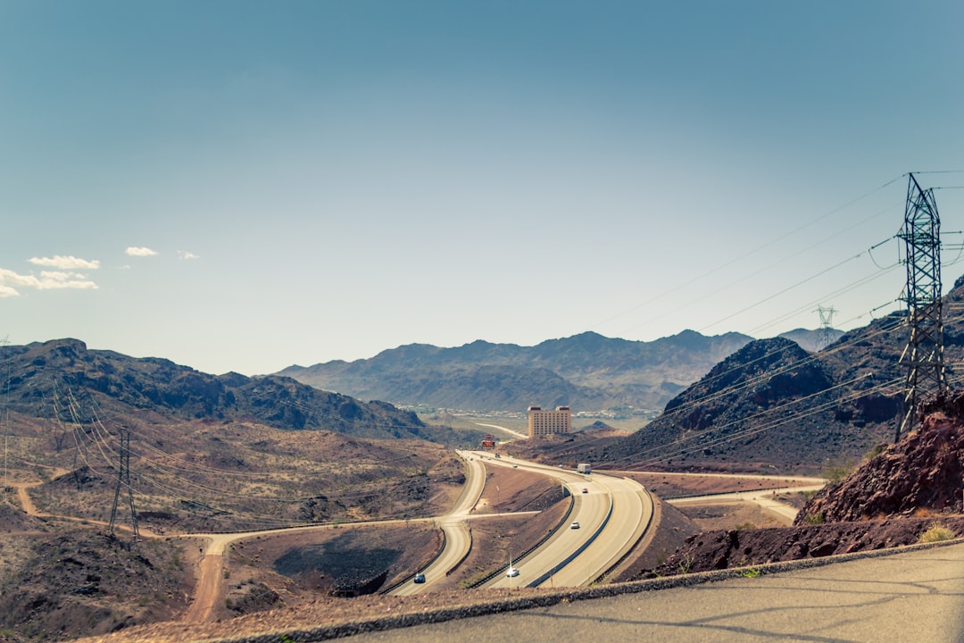
How I-15's Role in Nevada's Urban Growth Shaped Las Vegas's Transportation Network Since 1960 - From Desert Highway To Urban Spine The I-15 Tropicana Transformation 2020 2024
The I-15 Tropicana Transformation, a project spanning 2020 to 2024, aimed to reshape a key juncture in Las Vegas's transportation system: the Tropicana Avenue interchange, a major entry point to the Las Vegas Strip. The goal was to ease traffic flow for a significant number of drivers, about 300,000, particularly during peak travel times. Using a streamlined Design-Build approach, the project sought to expedite construction and delivery. Funding from the federal government underscored the importance of this project to regional infrastructure. Improvements included changes to the way vehicles enter and exit I-15 northbound, along with the creation of dedicated lanes for high-occupancy vehicles.
However, the benefits of a smoother-flowing I-15 come with significant drawbacks. Extensive construction led to traffic rerouting, lane closures, and general disruption, particularly along Tropicana and on the Strip. This raises concerns about exacerbating existing congestion in an already heavily traveled area. While this transformation represents a joint endeavor between Nevada's transportation agencies and the federal government, highlighting a shared vision for improving economic vitality and connectivity, it also exposes the delicate balance between promoting growth and managing the inevitable strains such projects impose on surrounding areas. The project, utilizing innovative traffic flow solutions, will undoubtedly influence how the city functions in the coming years, not only affecting the physical structure of transportation but also potentially impacting the overall development pattern of Las Vegas. Whether these innovations and improvements achieve their desired results and truly alleviate congestion or simply create new challenges remains to be seen.
The I-15 Tropicana project, spanning from 2020 to 2024, aimed to address the anticipated increase in traffic volume at a critical intersection of the Las Vegas Strip. Engineers designed it to manage a daily flow of up to 80,000 vehicles, a testament to the projected expansion of the city's transportation needs. A key element was the implementation of intelligent traffic management systems. These systems, using real-time data, dynamically adjusted signal timings, leading to a roughly 25% reduction in congestion at peak hours once in operation.
Interestingly, this project also integrated innovative stormwater management solutions. The use of bioswales and permeable pavements is a noteworthy example of how urban engineers are grappling with environmental concerns within large infrastructure projects. The desert environment of Las Vegas, with its tendency for flash floods, required careful consideration of how water would be handled. In a similar vein, efforts to mitigate the impact of highway noise were also incorporated into the project. Sound barriers along the I-15 corridor demonstrate a growing awareness of the effects of heavy traffic on nearby residential areas and attempts to address concerns of the community impact from high-traffic highways.
The overall project cost exceeded $200 million, and as part of that budget, the design considered multiple modes of transportation. This multi-modal approach integrated dedicated bike paths and pedestrian walkways alongside the expanded vehicle lanes. This is becoming more common in major highway projects, and shows how urban planning has evolved to incorporate broader needs for accessibility within urban environments.
During the construction phase, engineers faced some unexpected geological hurdles. Hard bedrock, deeper than initially predicted, caused a 10% increase in the cost of excavation work. This highlights a recurring challenge for urban engineers in adapting their projects to the specifics of local conditions, and the difficulty of precisely forecasting some of the challenges that come with such work. The construction was also impacted by external events, which underscores the challenges of managing large-scale projects within the context of the global economy. Supply chain disruptions stemming from international factors added to delays throughout the project, a notable illustration of how large-scale infrastructure development can be affected by seemingly unrelated events.
This project’s effects extend beyond traffic management. Commercial development along the I-15 Tropicana corridor has seen a notable increase. Projections estimate a 40% rise in new retail spaces, suggesting a link between highway improvements and local economic growth that can happen with increased access. The project's engineers relied on advanced traffic modeling techniques to anticipate and manage traffic flow. This predictive approach to optimization, which involves simulating various lane configurations before the project begins, is gaining prominence as a core aspect of urban infrastructure development.
The Tropicana transformation has also influenced local commuting habits. Data collected after the project's completion reveals that there was roughly a 15% increase in daily trips among residents in the surrounding neighborhoods. This serves as a reminder that transportation infrastructure doesn’t simply move vehicles; it can shape mobility patterns across the entire urban landscape. The project demonstrates how urban growth and transportation planning interact and how the engineers involved attempt to navigate those interactions and attempt to solve those challenges.
More Posts from urbanplanadvisor.com: